Thursday, February 11, 2010

Tech Update

While the big three mountain ranges in southern California were blanketed under yet another foot of snow this week, I worked on improving my mountaineering-related cyber-skills.  First, I finally figured out how to capture and edit a map image.  Here is one such result:


Second, using the first skill, I created my first route page on SummitPost, for Falling Fir Ridge on Ontario Peak. 

And third, I began the process of "claiming" (or registering) this blog on Technorati, a website that reports on the blogosphere, ranks blogs, etc.  Technorati weeds out the technologically weak with a series of irritating hurdles.  It took me eight (8) attempts to sign up.  Most of the failures were the result of inadequate username proposals (though in most of those cases it was unclear what the problem was).  Anxiety was added to this series of failures by my three-year old daughter, who was pacing around frenetically while repeatedly asking me to play and threatening to pee in her pants.  After finally overcoming the sign-up hurdle, I was required to demonstrate proficiency with RSS and atom feeds, of which I had none.  After some research, I bashed through that hurdle and arrived at yet another, which requires putting BCYQ45PKTV56 here.  If you don't know what BCYQ45PKTV56 is, then you have no business being on the internet.  Just kidding.  But seriously, you really should look into BCYQ45PKTV56.  If BCYQ45PKTV56 works out, then The Mountaineering Review will soon be on Technorati's radar screen.

Considering that it was not long ago that I learned, by trial and error, how to answer my cell phone, I am proud of my modest cyber-accomplishments.  But this is child's play compared to what is happening at the Hiking Science Blog.

Wednesday, February 3, 2010

CPR on Dobbs Peak


Several days after the mountains of southern California were blanketed under a few feet of snow, the Vivian Creek parking lot was finally plowed. Getting word of this, six of us decided to climb the West Ridge of Dobbs Peak.


Clouds enveloping the West Ridge of Dobbs Peak

At 10,459 feet, Dobbs Peak is overshadowed by its higher neighbors in the San Bernardino Mountains. It also has no maintained trail to its summit. But it does sport a long, well-defined, and easily accessible ridge on its western side. Having enjoyed the West Ridge when it was covered with consolidated spring snow, I thought it was worth trying in winter.

My alarm sounded at 3:00 AM on Sunday, January 31. Having been asleep for only four hours, I was disoriented and forgot why the alarm was ringing. Then I remembered. At 5:15 AM, I pulled into the Vivian Creek parking lot just as Bill Bryson was reading the last sentence of his engaging and hilarious audiobook In a Sunburned Country. The timing could not have been better. Things were looking up.
 
 
Galena Peak in the San Bernardino Mountains
 
After the five others arrived, two decisions were made. First, we would be taking the Vivian Creek Trail to the bottom of the West Ridge. There had been talk of climbing the steep slope due north of the parking lot, but in the dark it didn't look promising. I think that was a good decision. Second, we would be leaving the snowshoes behind, since the snow around the parking lot was frozen solid. That was a bad decision. Before starting up, I concluded my preparations as I normally do, with some quiet moments in the cold, dark outhouse. Centered and refreshed, I began plodding through the snow in pursuit of the others.

After crossing Mill Creek, we ascended uphill, lost the trail, and found ourselves climbing a steep gully. As rocks and other debris began rolling down, two members of our party decided to bail. That left four of us. While Norma, Patrick, and Zach continued up the loose gully, I veered right to avoid the rockfall. Before entering a steep, narrow couloir, I donned my helmet and swapped trekking poles for an ice axe. I then climbed about two hundred feet of solid, 45+ degree snow with a few sections of third class rock. Though I wished my crampons were on in the steep, hard snow, they would have seriously complicated the rock sections. I was relieved to reach the crest at the top of the couloir, but somewhat concerned to find a slope dropping steeply down on the other side. After traversing the slope for about two hundred feet, the angle lessened and I found myself in a flat drainage that I assumed was Vivian Creek. Within a few minutes, the three others popped over another crest and we were reunited.

Since we thought we were in the Vivian Creek drainage, we assumed the ridge to the west was the West Ridge of Dobbs Peak. But after postholing up to that ridge, we realized that Vivian Creek separated us from the West Ridge. Contemplating the terrain, and not wanting to lose too much elevation, we decided to make a descending traverse into Vivian Creek and then ascend a broad snow slope to the upper reaches of the West Ridge.


The CPR route on Dobbs Peak

After sinking to our knees all the way down to Vivian Creek, we were relieved to find a consolidated snowshoe track. While Norma, Zach, and I enjoyed the faster pace provided by the solid track, Patrick repeatedly plunged to his waist. We all agreed that Patrick was making a good decision when he decided to turn around. That left three of us.

At about 7,700 feet, we stood at the base of the broad drainage we had seen earlier. Here we left the trail and began plodding upward. The snow was in perfect condition. There was neither a breath of wind nor a cloud in the sky. It was almost too good to be true. Zach found a balloon and festively tied it to his pack. We were having fun.


Near the top of the CPR route

All good things come to an end. After a few hundred feet of elevation gain, it became very warm, the snow softened, and I began to wilt. Hours later, three bodies weary from sustained postholing flopped down at roughly 10,000 feet on the West Ridge. Though we were only about 500 vertical feet below the summit, the snow on the ridge was unconsolidated, which made for grueling progress. To make matters worse, the moist snow repeatedly caked all around my boots, making them very heavy.


Norma and Zach on the summit of Dobbs Peak

We finally arrived at the summit of Dobbs Peak at around 2:30, nearly nine hours after departing. We had ascended 4,500 vertical feet, much of it through unconsolidated snow. I was tired. Norma seemed rejuvenated. Zach had done more than his fair share of trail-breaking, but his balloon made him appear much more playful and energetic than he should have been.


Norma insisted that I take this picture of Zach, saying he looked cute.

Though we had hoped to continue to the summit of San Gorgonio, the late hour made that out of the question. So after having a snack which included peanut butter cups that Norma shared, we headed down.


Starting down the West Ridge of Dobbs Peak


Norma descending the West Ridge

It took 1.5 hours to descend 2,800 vertical feet to the trail, thanks to lots of glissading. During that time, we were enveloped in cool mist. From the trail, it took another 1.5 hours to reach the cars in the dark at 6:00 PM.

Hiking down the Vivian Creek Trail, I mentioned that I had never heard of anyone doing the route we had just done on Dobbs Peak. Though the West Ridge is a relatively popular route, our route ascended roughly 2,300 vertical feet between the Vivian Creek Trail and the West Ridge. To make a long story short, our route needed a name. Norma jokingly suggested the West Buttress, but I countered that associating our route with one on Denali would demean ours. Norma also jokingly suggested the Western Cwm, and though we all agreed that the word "cwm" has a lot going for it, we also realized that our route did not ascend a cwm. I facetiously suggested calling it the Cyrus-Page-Ryan route, which somehow sounded awfully presumptuous. But then, in a stroke of genius, Zach blurted out "CPR". And thus our route was named. CPR was fitting in several ways. The first way is obvious. Secondly, Norma and Zach both work in the medical field. Third, we were all close to needing CPR at various stages of our posthole marathon.

 
Jeff Scofield took this photo while we were climbing the CPR route on Dobbs Peak.

Friday, January 29, 2010

Review of "Annapurna South Face"

Thirty-nine years after its publication, I finally got around to reading Annapurna South Face by Sir Chris Bonington. The book is an account of the expedition Bonington led on the South Face of Annapurna in 1970.

At 8091 meters, the summit of Annapurna is the tenth highest in the world. Though Annapurna was the first 8000-meter peak to be climbed (by a French expedition in 1950), it is often considered to be the hardest. According to various websites, Annapurna is the least frequently climbed 8000-meter peak, but has the highest fatality rate: for every two climbers who have summitted, roughly one has died trying. It was also the last of the fourteen 8000-meter peaks that Ed Viesturs climbed, and it took him three expeditions before he reached its top.

On May 27, 1970, two members of Bonington's expedition – namely, Dougal Haston and Don Whillans – made it to the summit after roughly two months of hiking and climbing. They missed getting the second ascent of Annapurna by a matter of days. Their achievement was supported by the incredibly hard labor and commitment of dozens of other climbers and Sherpas. One merit of Bonington's book is its emphasis on the tremendous sacrifices others made to position Haston and Whillans for their summit bid.

It seems to me that major mountaineering expeditions are like human pyramids, in that the person on top is not necessarily the hardest working or most competent member. In the case of a human pyramid, the person on top deserves no more credit than anyone else. But for some reason, in mountaineering expeditions the persons who summit tend to get more credit and reap more rewards than anyone else. Think of Sir Edmund Hillary and Tenzing Norgay. Few people could name any other members of their expedition. Off the top of my head, I can only think of one – the leader of the expedition. One could argue that on many major mountaineering expeditions the supporting climbers deserve most of the credit, because the climbers who summit are already rewarded by getting to stand on the summit.

In addition to giving credit where credit is due, Bonington provides an unmistakable sense of the difficulty and complexity of a major mountaineering expedition. The book is actually a bit tedious in this regard, but after 100 pages of details about ferrying loads between high camps, one is unlikely to forget that element. One surprising and disappointing feature of the book, especially in light of how much attention is given to load-ferrying, is how little is devoted to the successful summit day. Seemingly out of the blue, after almost three hundred pages, Bonington announces that Haston and Whillans reached the summit and then defers to Haston's hurried account of what transpired from May 17-27. Bonington then concludes with a few pages about the descent to base camp, which included the death of the accomplished climber Ian Clough in an avalanche. Though Bonington devotes an almost negligible amount of text to summit day, he certainly cannot be faulted for giving excessive credit to the climbers who managed to summit.
 
 
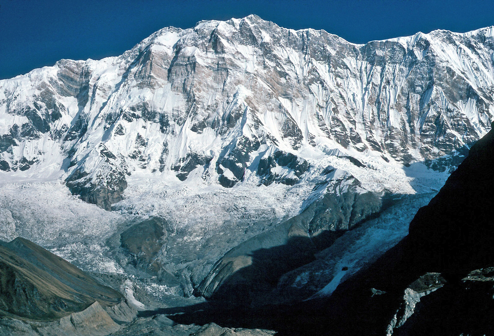
The South Face of Annapurna (photo by Wolfgang Beyer, Wikipedia)
 
Ian Clough's death on Annapurna was not the only fatality on one of Bonington's expeditions. From 1975-1982, four more of Bonington's British teammates died on Himalayan expeditions he led – namely, Mick Burke, Nick Estcourt, Peter Boardman, and Joe Tasker. Clint Willis does an excellent job of chronicling these expeditions and their consequences in The Boys of Everest: Chris Bonington and the Tragedy of Climbing's Greatest Generation (2007, 560 pages). Reading that book made me wonder about the propriety of leading expeditions that repeatedly kill people, but I've reached no conclusions.

Considering that Bonington was 35 years old when he led the Annapurna expedition in 1970, it is amazing how active he still is at 75. This past September he climbed Mont Blanc. This May he will be participating in a 22-day trek in the Annapurna region of Nepal. The trek will serve as a 50-year anniversary of his first ascent of Annapurna II (7937 meters) in 1960. Think about that. Bonington climbed a major peak in the Himalayas fifty years ago and will be trekking back to it this year. If you cannot keep up with Sir Chris Bonington in the mountains, you can at least keep up with his personal website or Berghaus blog.

Sunday, January 24, 2010

Two New Routes on Tawoche (with Remarks on Fowler-Littlejohn)

In the last two months, two new routes have been climbed on Tawoche (~6500m), a spectacular peak near Mt. Everest.


Tawoche on the left (photo by Uwe Gille, Wikipedia)

In late November, Fumitaka Ichimura and Genki Narumi climbed the Direct North Face, which involved 1500 meters of steep and dangerous ice/snow. The climb took four days round trip from a base camp at roughly 5000 meters. They spent two nights on the face sitting on ledges with no tent. For more details, see Alpinist and Climbing.

Just a few days ago, Renan Ozturk and Corey Richards climbed Tawoche's South Central Buttress. From a base camp at around 5000 meters, two days of rock climbing and a third day of ice climbing brought them to the summit. They then rappelled their route of ascent. Though they were able to set up a tent at their two camp sites on the wall, there was no water or snow at their first site, so they went 36 hours without water. Sophisticated video dispatches are posted on Ozturk's blog, which are well-worth watching.

Reading about these recent climbs reminded me of the first ascent of the Northeast Buttress on Tawoche by Mick Fowler and Pat Littlejohn in 1995. Though Fowler's American Alpine Journal article, entitled Tawoche: A Retrospectively Pleasurable Ascent, is well-written and even hilarious, it has one glaring omission: it neglects to mention the extremely minor contribution I made to the expedition.

For 45 days in the spring of 1995, I was trekking in the Khumbu Himal. Near the end of my trip, I was lounging around the Peace Zone tea shop in Pheriche when four British guys approached on the trail. They looked like novice trekkers who were out of their element. After they settled in at the tea shop, I inquired about their plans, assuming that what I had already done would be more impressive than what they were going to do. Mick Fowler, who was one of the novice trekkers, said, "Well, do you want to have a look?" That was the first indication that something was awry. From the path outside of the Peace Zone, I was astonished to watch as he pointed out a route up the jaw-dropping Northeast Buttress of Tawoche. Speechless, it was clear that I was the novice and they were the pros. As if to emphasize the point, Chris Watts handed me a picture of Tawoche torn from a magazine. Absentmindedly turning the page over, I was amazed to see a full-page advertisement featuring him rock climbing.

Having been put in my place, I hung around the Peace Zone for a few more days while Fowler, Watts, Pat Littlejohn, and Mike Morrison acclimated and waited for porters to arrive with gear. Eager to establish base camp below the buttress, they huddled to figure out how to deal with the lagging porters. Overhearing their discussion, I offered a solution which was promptly dismissed. A day or two later I asked how the logistical problem was solved and was surprised to hear that my solution had been adopted.

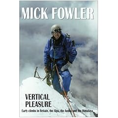
Mick Fowler was awarded the Piolet d'Or in 2003. He has also written two excellent books: Vertical Pleasure: The Secret Life of a Tax Man (1995) and On Thin Ice: Alpine Climbs in the Americas, Asia and the Himalaya (2005). Had I not met Fowler below Tawoche, I probably would not have read his books, which in my opinion are among the best in the mountaineering genre. For a sample of his writing, see the AAJ link above or Fowler's occasionally updated blog.

Monday, January 18, 2010

Santiago Peak


Deb approaching the summit of Santiago Peak with the snowy Mt. Baldy behind

When the time since my last moderately strenuous mountain climb creeps beyond two weeks, I start getting restless.  My last outing had been a hair-raising day on Mt. Baldy, but that was more than three weeks ago.  I had planned a New Year's ascent of Mt. Washington in New Hampshire, but spent nearly two weeks cooped up at my in-laws' house with bronchitis instead.  Needless to say, I was feeling antsy.    

After negotiating with my wife, I managed to get a day away from the kids on Sunday, January 17.  To my delight, SoCal Hikers and Peakbaggers had a climb of Santiago Peak scheduled for that day.  After some dithering, I committed to the outing by RSVPing "yes". 

"Can you be home by 4:00?", my wife asked.  I smiled sheepishly.  After failing on several occasions in recent months to return from hikes at the promised time, I opted to say nothing.  I was not going to once again say, "I will probably be home by X but definitely no later than Y", only to arrive home hours after Y.

I had wanted to climb Santiago Peak since moving to Orange County, California in August.  At 5,687 feet, Santiago Peak is the highest point in Orange County.  The mountain dominates the surrounding terrain and bristles with telecommunication towers on its summit. 

At 6:45 AM, eight of us met at Cook's Corner and then drove a few miles to the beginning of Trabuco Creek Road.  At this point, those of us with low-clearance vehicles parked and hopped into high-clearance vehicles for the bumpy, five-mile ride to the trailhead.  Kirk and Erin were gracious enough to give me a ride.  Once we were all assembled at the trailhead, Gerry Frayer, the trip organizer, provided some details about the route.  After being asked how long the hike would take, Gerry mentioned his fastest time before offering a longer estimate for our group.  Upon hearing Gerry's fastest time, Tari, Tina, and Erin (another Erin) immediately blasted off.  We didn't see them again until the summit.


Gerry Frayer in his element

The lower section of the Holy Jim Trail is well-maintained  and remains at a consistently low angle for about five miles until it intersects the Main Divide Truck Road.  At the road, we opted to continue climbing the upper section of the Holy Jim Trail, which is less maintained and steeper.  After another mile or so, we again intersected the road and followed it for roughly two miles to the summit.  Wandering around the roads and buildings on the summit cone, I eventually found the high point, which was confirmed as such by a National Geodetic Survey marker and summit log. 


Sam, Deb, Gerry, Erin, and Kirk (L-R) on the summit

From the summit, one still has eight miles of descending to do.  One also has to dodge the trucks and motorcycles on the road.  At one point, I stood on the side of the road and watched about twenty motorcycles roar past.  Next to mountain lions, the motorcycles have to be the second most worrisome hazard on this hike.  Another slight concern on this particular hike were the clouds that had rolled in and enshrouded the summit -- a harbinger of the week-long storm that was forecasted to wallop California.  But our timing could not have been better.  It was not until we were bidding farewell at the bottom that the first drops of rain began falling.


Gerry, Deb, and Erin (L-R) on the road with Kirk and Mt. San Gorgonio behind 

Hiking with a group of strangers, I worried that some stragglers would keep me from getting home by 4:00.  I couldn't bear the thought of arriving home hours late after yet another underestimated hike to see my wife in a state of near-collapse after a day alone with our two small, insane children.  But I needn't have worried.  Every hiker in the group was fast (or at least as fast as me).  In fact, Gerry is planning one of the most audacious day hikes I have ever heard of: 10,000 feet of elevation gain and 48 (forty eight) miles in the Grand Canyon . . . in one day.  Though I enjoyed the hike Gerry led on Santiago Peak yesterday, I think I'll have to pass on his Grand Canyon hike.

And now, the numbers: 16 miles, 4000 vertical feet, 7 hours, 0 mountain lions (as far as we know).

Thursday, January 14, 2010

Review of "Where Men Win Glory"

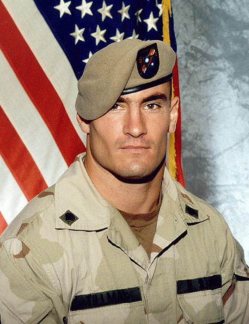
Jon Krakauer's most recent book, published in 2009, is Where Men Win Glory: The Odyssey of Pat Tillman. Like Krakauer's other well-known books – namely, Into Thin Air, Into the Wild, and Under the Banner of Heaven – this book revolves around death. In 2004, Pat Tillman, a professional football player turned Army Ranger, was killed by friendly fire in Afghanistan. Over the course of 416 pages, Krakauer not only tells the story of Tillman's life and death, but also the broader geo-political forces that overwhelmed him.

Pat Tillman was an incredibly strong, philosophical, athletic, articulate, and disciplined person who quit professional football after the 2001 season to serve his country. Deciding that it was the right thing to do, Tillman enlisted in the Army, turning down millions of dollars in the process. Tillman also left behind his beloved wife, with whom he enjoyed a fairytale marriage.

By itself, Krakauer's biography of Tillman is fascinating. However, Krakauer's book covers much more ground than that. It provides a recent history of Afghanistan, a survey of events leading up to the invasions of Iraq and Afghanistan, and an eye-opening exposé of the circumstances surrounding the rescue of Jessica Lynch. But most centrally and importantly, Krakauer's book reports how Tillman really died and the elaborate steps that were taken to cover it up. As is often the case, the cover-up became a disaster in its own right. "O what a tangled web we weave, when first we practice to deceive."

This book is riveting from start to finish, with the exception of the recent history of Afghanistan. However, had I not read so many books on Afghanistan in the last few years, I may not have found myself daydreaming during that section. Because Where Men Win Glory is both a gripping biography and a sweeping historical narrative, I suspect that it will be taken seriously for years to come.


Sunday, January 10, 2010

Review of "Where the Mountain Casts Its Shadow"


Most mountaineering books are written from the perspective of mountaineers. In Where the Mountain Casts its Shadow: The Dark Side of Extreme Adventure (2003), Maria Coffey writes about mountaineering – mostly high-altitude mountaineering – from the perspective of the family and friends of mountaineers. Coffey was in a relationship with Joe Tasker when, in 1982, he and Peter Boardman disappeared trying to make the first traverse of the pinnacles on the Northeast Ridge of Mt. Everest.

High-altitude mountaineering places tremendous stress on the family and friends of mountaineers. First, expeditions to the greater ranges routinely require three or more months, in addition to the time necessary for preparation and recuperation. During that time, the spouse is left to juggle childcare, work, and all other facets of home economics by his or her self. Second, and most obviously, extreme mountaineering is incredibly dangerous. One of the merits of Coffey's book is that it chronicles a staggering number of mountaineering injuries and fatalities, while emphasizing their effects on family and friends. It is remarkable, not to mention depressing, how many accomplished mountaineers have died mountaineering. He who lives by the ice axe dies by the ice axe.

Coffey interviewed scores of people for her book. Much of the book is comprised of quotations from those interviews. This is both a strength and weakness of her book. On the one hand, with all of the interview excerpts, it is sometimes hard to keep track of who is talking. On the other hand, the dizzying array of testimonials leaves the reader with a clear and undeniable sense of the negative impact of extreme mountaineering on family and friends – their uncomfortable shoes are put on the reader's feet and laced tightly for 229 pages.